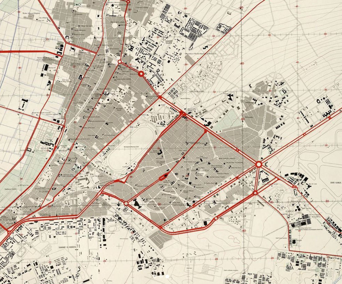
A more accurate map of Cairo dated 1958. The highly detailed map not only includes landmarks, but also built-up areas, roads and streets, rows of trees, schools, churches, mosques, synagogues, hospitals, gardens, power lines, railroads, diplomatic missions, tram lines, tunnels and more. The map was compiled by the US Army Maps Service based on maps published by the Survey of Egypt. The consulted maps from the Survey date from 1945, 1951, and 1956. Source: University of Texas Libraries. Image courtesy of Cairo Observer.
Maps can be a fascinating gateway to how extensively things change with time. A lot of the time, people always make remarks of how much Egypt has changed, or how beautiful it was in the past, and we share images that showcase an Egypt most of us are wholly unfamiliar with, yet nostalgic for.
But perhaps the most sure way of truly reflecting on how much the country has changed, is through its infrastructure. Maps have always been an integral part of life, since ancient times – we use them to navigate and identify, and without them we’d literally be lost.
Through this collection of vintage maps of both Egypt and Cairo in specific, one can observe how much the country’s infrastructure has changed over time and reflect on what it has meant for the country as a whole. The last few maps showcased, along with the interesting information accompanying them, were gathered from the wonderful account Cairo Observer (an account dedicated to collecting remnants of Egypt throughout history and providing context alongside them).
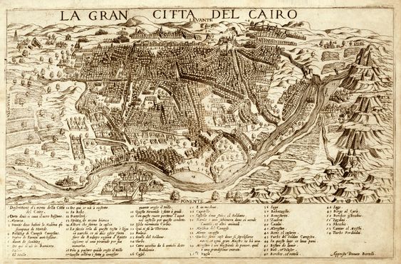
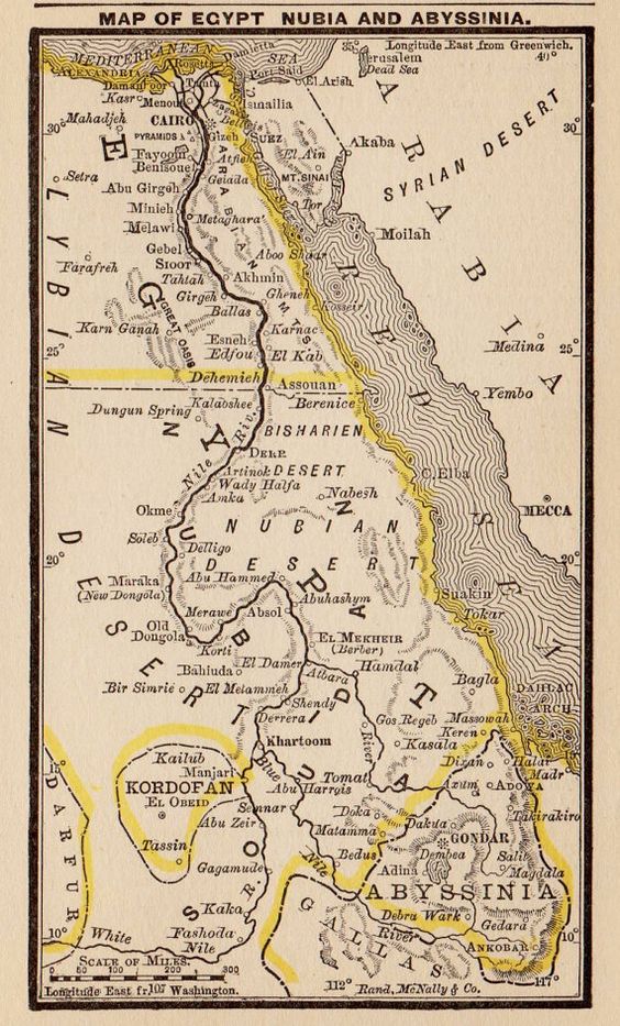
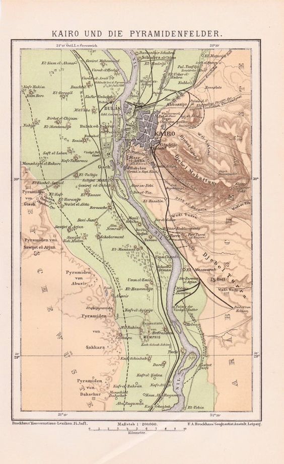
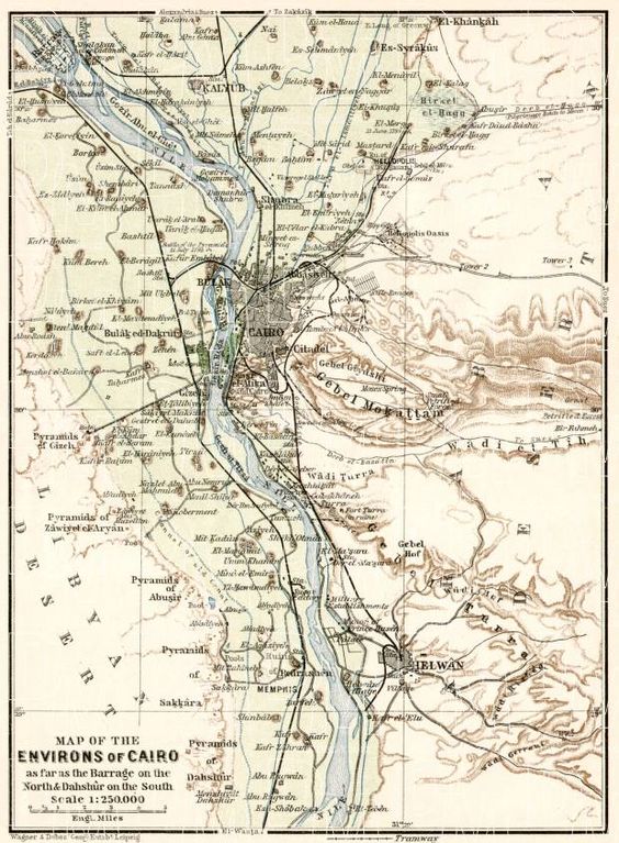
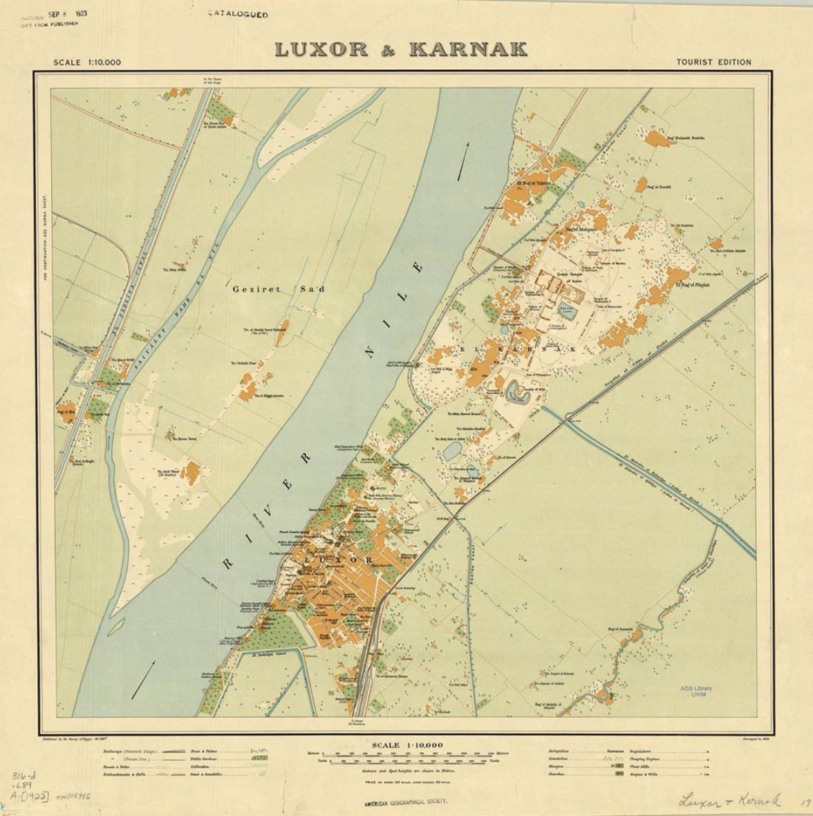
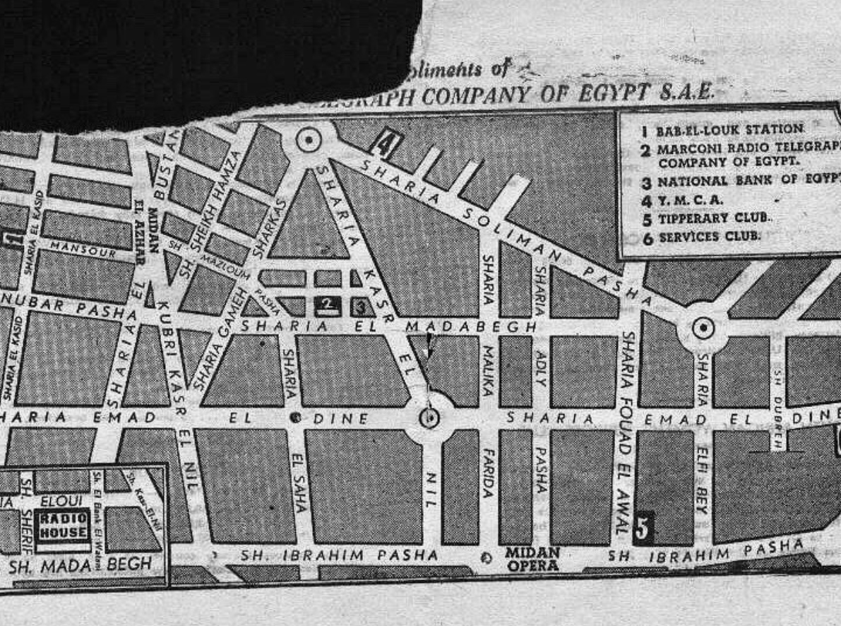
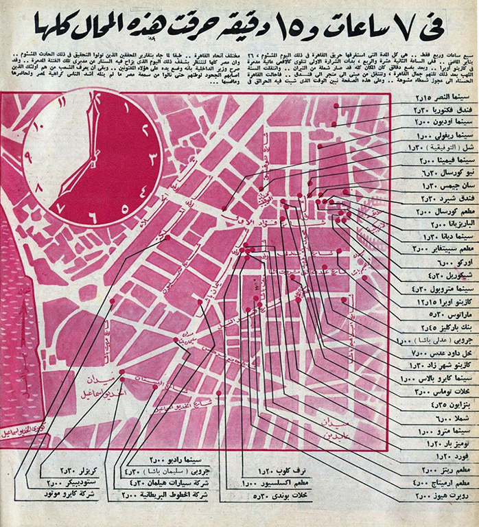
A 1575 map of Cairo. Image source unknown.An 1887 map of Egypt. Image source unknown.An 1890 map of Egypt. Image source unknown.A 1911 map of Cairo. Image source unknown.A 1922 map of Luxor. Source: University of Wisconsin Milwaukee Libraries. Image courtesy of Cairo Observer.Map of downtown Cairo in 1939, compliments of the Telegraph Company of Egypt, included in a survival guide to the city given to British soldiers deployed in Cairo during WWII. The map shows the location of five essential places: Bab El-Louk Station (demolished, #25 in #cairosince1900), Telegraph Company, National Bank of Egypt (#32 in #cairosince1900 , YMCA, Tipperary Club, and Service Club. Bab Al-Louk Square is identified as Midan Al Azhar. Image courtesy of Cairo Observer.Map of the Cairo Fire of January 1952, which was an important event in the city’s history, but in the absence of a conclusive investigation, many questions remain unanswered. This map was published by the popular magazine Al Musawwar in March 1952 shows the extent of the arson in the downtown area. The forensic map identifies the various sites affected by the fire with the times they were set ablaze. The targets are high end shops, department stores, airline offices, cinemas, casinos, gas stations, car showrooms, cafes and hotels. The headline reads “in seven hours and fifteen minutes all these places burned.” Image courtesy of Cairo Observer.A more accurate map of Cairo dated 1958. The highly detailed map not only includes landmarks, but also built-up areas, roads and streets, rows of trees, schools, churches, mosques, synagogues, hospitals, gardens, power lines, railroads, diplomatic missions, tram lines, tunnels and more. The map was compiled by the US Army Maps Service based on maps published by the Survey of Egypt. The consulted maps from the Survey date from 1945, 1951, and 1956. Source: University of Texas Libraries. Image courtesy of Cairo Observer.


Comment (1)
[…] (function(d, s, id){ var js, fjs = d.getElementsByTagName(s)[0]; if (d.getElementById(id)) {return;} js = d.createElement(s); js.id = id; js.src = "https://connect.facebook.net/en_US/sdk.js"; fjs.parentNode.insertBefore(js, fjs); }(document, 'script', 'facebook-jssdk')); Vintage Maps of Egypt — to egyptianstreets.com […]